
Supplementary Material of ‘Northeye (Re)Constructed: Augmented Reality of an Abandoned Medieval Village.’
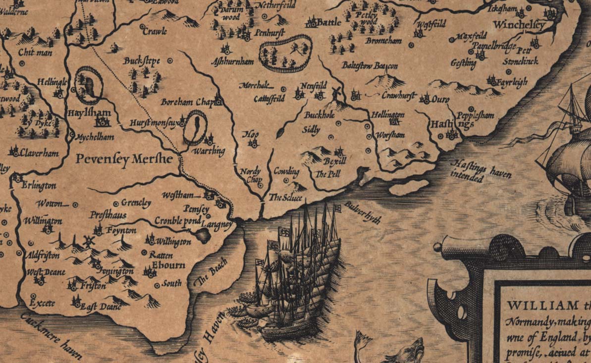
Figure 1. Detail of Speed’s map of Sussex (1610) showing “Nordy Chap.”
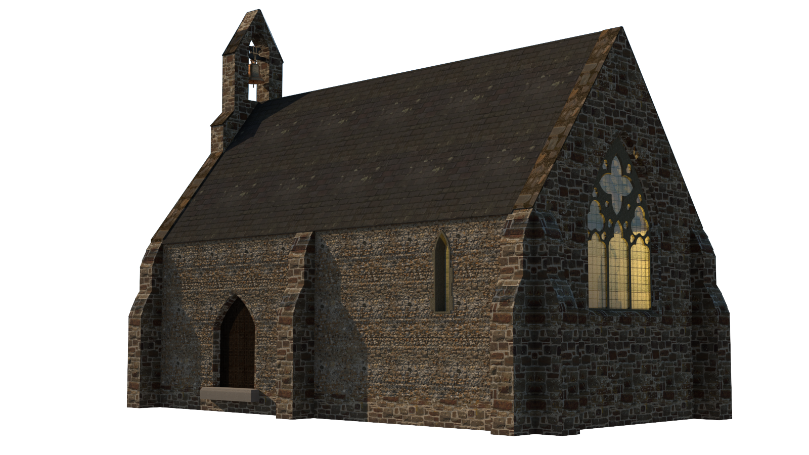
Figure 2. 3D model of the Chapel of St. James at Northeye.
Figure 3. Medieval sheet bronze cauldron from Northeye, Bexhill Museum.
Figure 4. Line-drawn…
Listed in Image | publication by group Iter Community
Version 2.0 - published on 29 Jul 2026 doi:10.25547/A2TW-GB77 - cite this Last public release: 4.0
Licensed under Creative Commons BY-NC 4.0




Description
Figure 1. Detail of Speed’s map of Sussex (1610) showing “Nordy Chap.”
Figure 2. 3D model of the Chapel of St. James at Northeye.
Figure 3. Medieval sheet bronze cauldron from Northeye, Bexhill Museum.
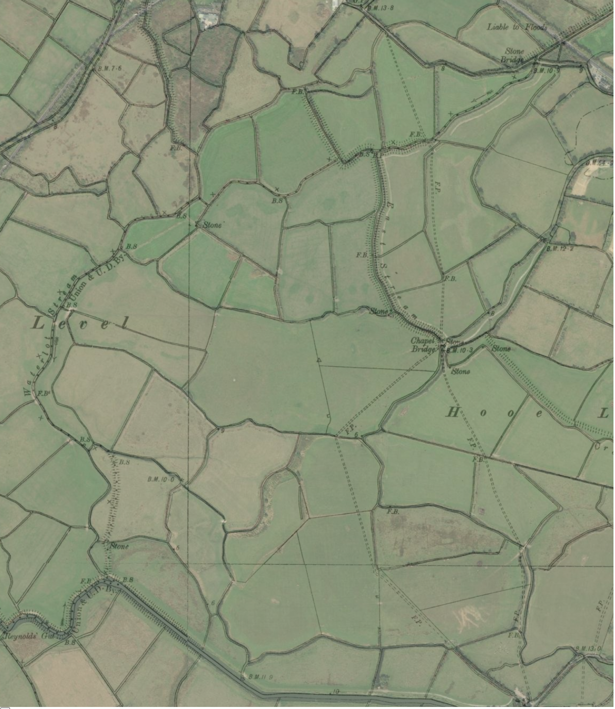
Figure 4. Line-drawn OS six-inch map (1899) overlaid with 50 percent transparency of Esri World Imagery to show green fields. Map includes East Stream, Waterlot, and drainage ditches around the village of Northeye, including the “New Cut” of Waller’s Haven at the bottom. Image credit: Reproduced with the permission of the National Library of Scotland.
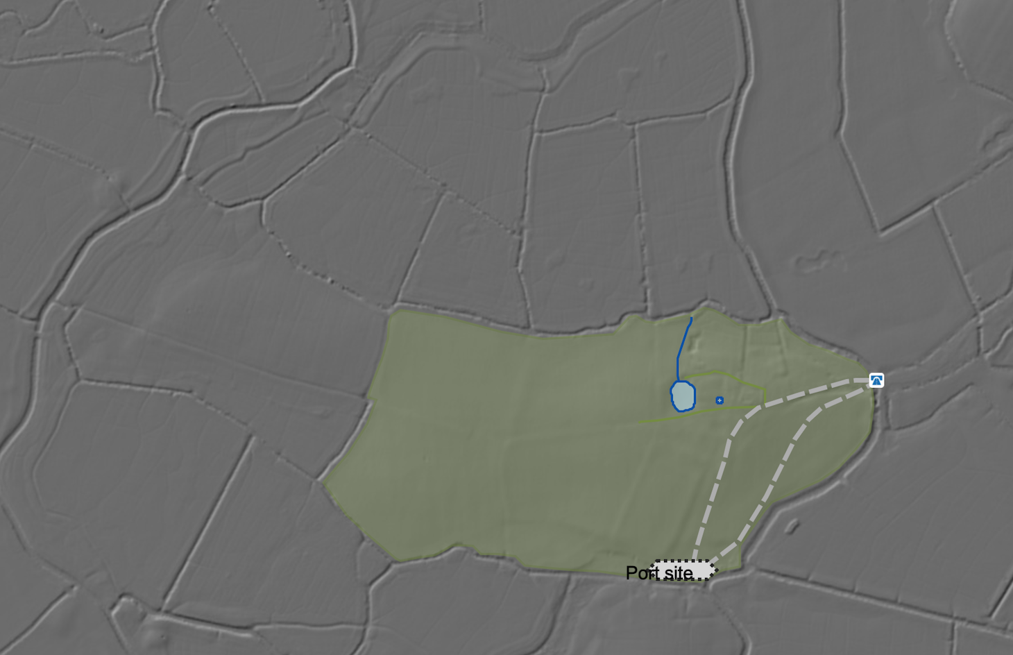
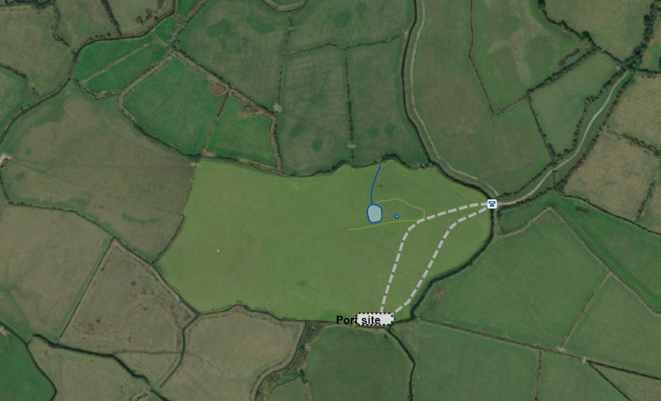
Figure 5a. Showing Northeye in the green area: 1-m LiDAR with sunken trackways in gray dashed lines leading from “stone bridge” to the presumed port site.
Figure 5b. Showing Northeye in the green area: sunken trackways in gray dashed lines leading from the “stone bridge” to the port, Esri satellite imagery.
Figure 6. Detail of a composite map of medieval Northeye with building mounds, salt mounds, and port site in gray.
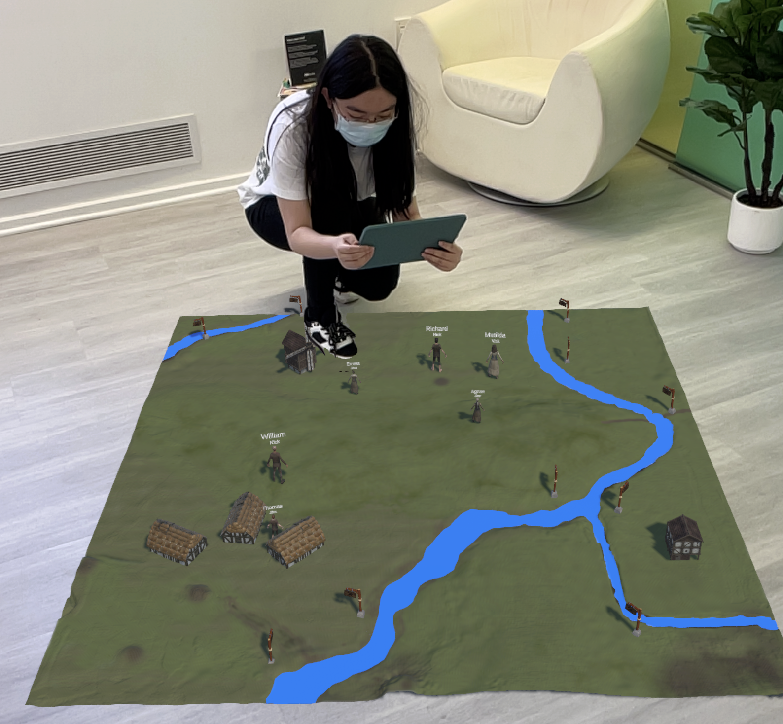
Figure 7. View of Northeye Village station, showing a villager heading to work. A station marker is shown in the background.
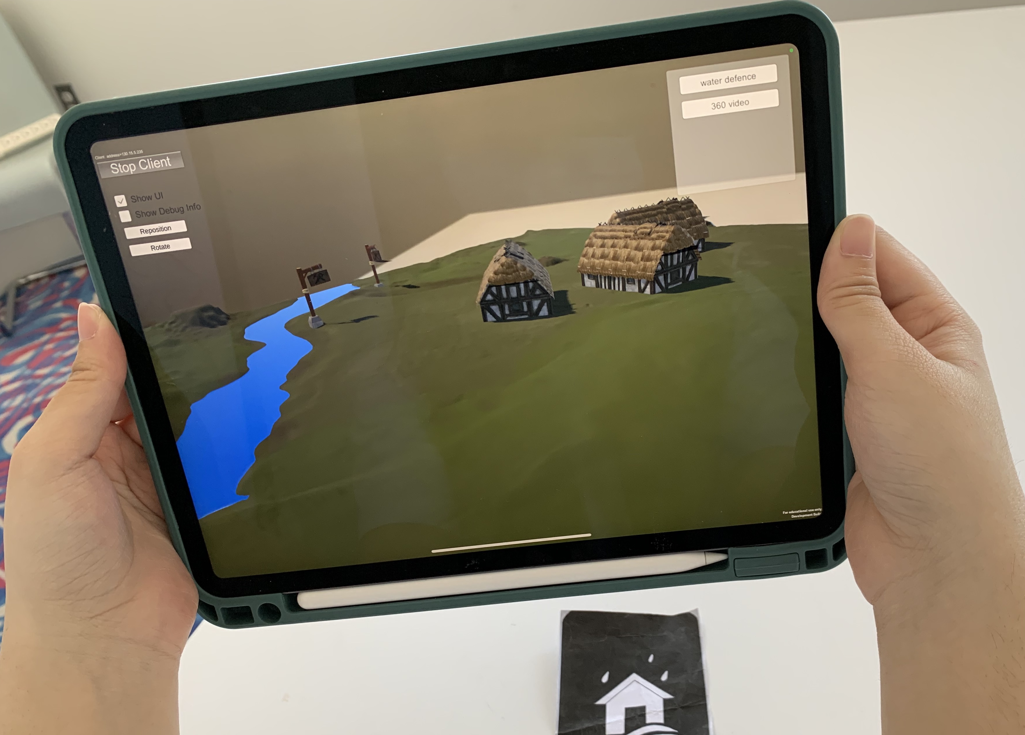
Figure 8. Station showing the environs around Northeye. A player can select farmland within this station and specify that villagers are to cultivate it. Crops will grow in real time.
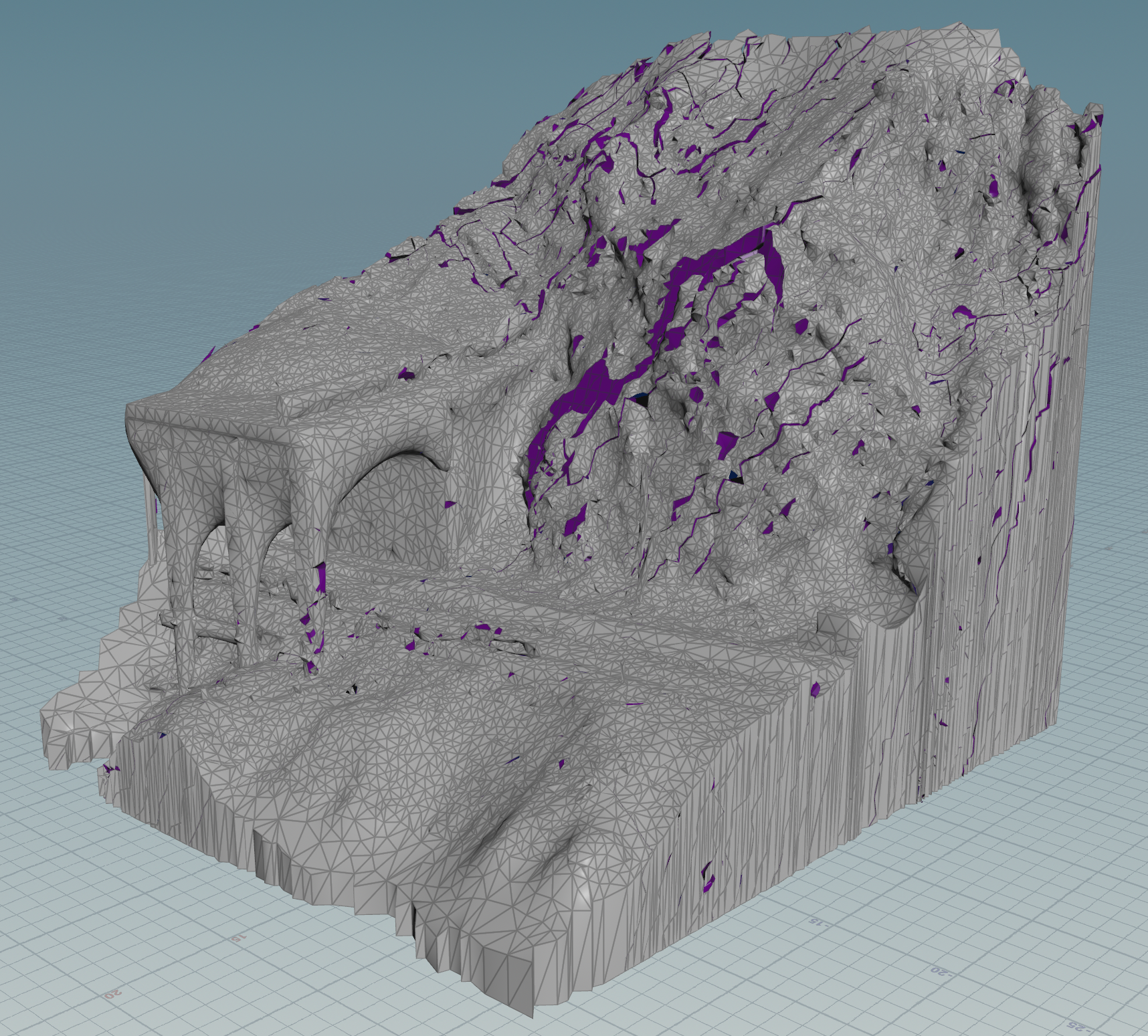
Figure 9. Slope failure model in Houdini. The triangular mesh is the terrain, and the purple areas have cracked (linear zones) or failed and fallen (larger areas) due to slope processes.
Figure 10. Random placement of trees and undergrowth in a landscape with local pools of water, built in Houdini and visualized in Unity using simple example vegetation models as placeholders. The trees prefer slopes and avoid pools of water, while the sedges prefer flat ground and do not avoid water.
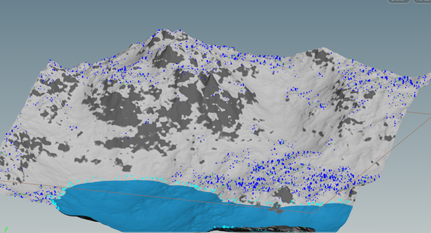
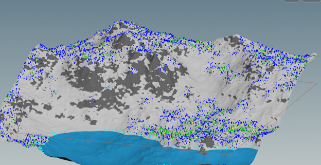
Figures 11a–c. Ecosystem evolution on a simulated landscape. The three images show species spreading, with successor species moving in to replace them over time. Note the presence of species that prefer to be along shorelines.
Location in HSS Commons repository
Please see 'Notes' below for any suggested/official citation information added by the author(s) of this work. Otherwise, you can cite the HSS Commons instance of this publication as follows:
- Steven Bednarski, T. C. Nicholas Graham, Robin Harrap, Zack MacDonald, Andrew Moore, (2026), "Supplementary Material of ‘Northeye (Re)Constructed: Augmented Reality of an Abandoned Medieval Village.’", HSSCommons: (DOI: 10.25547/A2TW-GB77)
Tags
Notes
Bednarski, Steven, et al. 2025. “Northeye (Re)Constructed: Augmented Reality of an Abandoned Medieval Village.” In New Technologies and Renaissance Studies IV: The Changing Shape of Digital Early Modern Studies, edited by Randa El Khatib and Caroline Winter, 341–80. New Technologies in Medieval and Renaissance Studies 12. Iter Press. https://iterpress.org/9781649591197/new-technologies-and-renaissance-studies-iv/
Publication preview
Iter Community

This publication belongs to the Iter Community group.
When watching a publication, you will be notified when a new version is released.